The Chisos Basin is open through Spring, making this a great time to visit!
Exciting news! The Chisos Basin at Big Bend National Park will remain open through April 2026! That means you have all of Fall and Winter and most of Spring to get your BBNP “fix”.
Tom and I started visiting BBNP during our honeymoon in 2016 and have hiked the trails, visited the exhibits, and taken in the scenic drives many times, especially after we moved here in 2019 to open Alpine Bed and Breakfast. We haven’t explored it all yet, but we’ve discovered that there’s something for everyone.
Today we’re going to take you to our favorite places in Big Bend National Park. Some are hikes, some are drives, some are views, and some are exhibits, but all are worth the visit.
Kick Off Your Trip with the Just Ahead App

Just Ahead App by the National Parks Service
The first thing we recommend to everyone visiting BBNP is to download the National Park Service app, Just Ahead. It’s a hands-free audio guide that talks to you as you drive, pointing out what you’re seeing and sharing stories about the park’s history, wildlife, and landmarks.
The best part is that it works without cell service, which makes it perfect for Big Bend. The Big Bend guide is free and makes the drive part of the adventure. You’ll know which overlooks are worth pulling over for, what trails to watch for, and how the landscape took shape over time. It’s also directional, so even if you return to Alpine on the same road you drove in, Just Ahead will highlight new points of interest on the way back north.
You can find it at JustAhead.com or through the App Store and Google Play. Be sure to download and start the app while you still have cell service or Wi-Fi because, even though it doesn’t require service to run, it does require it to orient itself and start.
Views and Exhibits
Fossil Discovery Exhibit (wheelchair accessible)
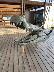
Deinosuchus at the Fossil Exhibit
Located along the main road between the BBNP entrance on Highway 385 and Panther Junction, the Fossil Discovery Exhibit is one of the park’s most fascinating stops. It is completely outdoors, with shaded displays and life-sized bronze replicas of prehistoric creatures that once roamed this part of Texas. The exhibit walks you through how Big Bend transformed from an ancient sea, to a lush coastal world full of giant reptiles, to the desert landscape we see today.
One of the highlights is a life-size model of Quetzalcoatlus, the enormous pterodactyl-like animal discovered in Big Bend. With an estimated wingspan of more than 35 feet, it is considered the largest flying animal ever found. Just a few steps away you will learn about Deinosuchus, a massive crocodile-like predator that ruled this region during the Late Cretaceous. While people often picture T. rex as the king of its era, in Big Bend it was Deinosuchus that sat at the top of the food chain.
This stop is a great way to understand the dramatic ancient history of the park, and it gives visitors of all ages something to marvel at before or after a day on the trails.
This exhibit is fully accessible. Pathways are paved and gently graded, and the displays are easy to view from a seated position. Parking includes accessible spaces, and the walk from the lot is short and smooth, making this an excellent stop for visitors of all mobility levels.
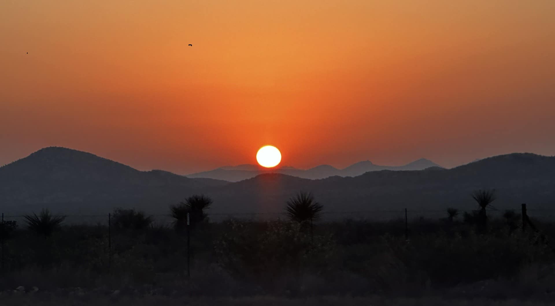
Window View Trail (wheelchair accessible)
Sunset view of the Window by Cindi Kisiel-Smith on Locationscout
The Window View Trail is a short, paved trail that starts right at the Chisos Basin Visitor Center and is only about 0.3 miles round trip. It is an easy walk with benches along the way and a big reward at the end. The trail leads to a wide-open view of the Basin and the “Window,” a natural V-shaped notch in the mountains that frames the desert floor below.
The view faces southwest, which is why this spot is so popular at sunset. In fall and winter, when the sun sets farther south, the light often drops right through the gap or glows directly around it. In spring and summer, the sun sets slightly off to the side, but the Basin still lights up beautifully and the sky often turns warm shades of gold and pink. It is one of the easiest places in the park to enjoy a memorable evening without a long hike.
The path is smooth, step-free, and listed by the National Park Service as wheelchair accessible. Manual wheelchair users may want a little help on the gentle incline, but it is a great option for visitors of any mobility level who want to take in one of Big Bend’s classic views.
Hikes
The Chisos Basin: Heart of the Park
Big Bend National Park Window Trail
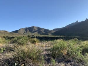
The Chisos Basin is the hiking hub of Big Bend. It sits at about 5,400 feet in a protected pocket of the Chisos Mountains, surrounded by rugged peaks and cooler air. The road climbs more than two thousand feet from the desert floor, and each turn opens up bigger views than the last.
From here you can reach many of the park’s most famous trails, including the Window, South Rim, and Emory Peak routes. These trails range from short walks to all-day adventures, and every one of them offers moments where the scenery stops you in your tracks.
The Basin first welcomed visitors when Big Bend became a national park in 1944. The Civilian Conservation Corps worked throughout this region in the 1930s, including on the road that climbs into the Basin, and the Chisos Mountains Lodge opened in the early 1960s. Today it remains the center of hiking in the park and a favorite place to take in cooler mountain air and incredible views.
Hikes from the Chisos Basin
Chisos Basin Loop Trail
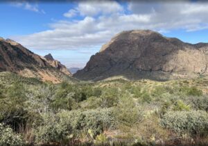
Photo by Olivia Cooper on AllTrails
Distance: 1.8 miles round trip
Elevation gain: 350 feet
Difficulty: Moderate
AllTrails rating: 4.6
Trailhead: Chisos Basin Visitor Center
Chisos Basin Loop Trail is well-maintaned and perfect for beginners. The loop circles through oak and pine forest, offering frequent glimpses of the Window and the desert far below. It is a good introduction to hiking in the Basin, with short climbs, shaded stretches, and a few benches to rest and enjoy the view.
Pinnacles Trail to Emory Peak
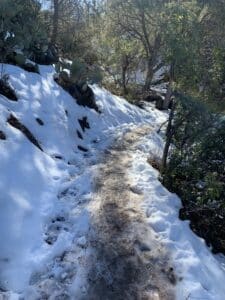
Snow and prickly pear on the Pinnacles Trail
Distance: 10.5 miles round trip
Elevation gain: 2,775 feet
Difficulty: Strenuous
AllTrails rating: 4.8
Trailhead: Chisos Basin
Emory Peak is the classic climb to the highest point in Big Bend, 7,825 feet above sea level. The route starts on the Pinnacles Trail, then follows a spur to the summit. The final scramble to the top is short but steep, and the reward is a 360-degree view of mountains and desert that seems to go on forever.
On the way to Emory Peak
Tom and I have done this hike three times, and our first attempt was unforgettable for all the wrong reasons. It was just days after the New Year’s Eve snowstorm of 2020, and because the road to the Basin was only open in short stretches due to repairs, we didn’t get started until 11:30 am. Between the two of us we had three phones, none fully charged, no flashlight, and only leftover Halloween candy and a couple of tangerines for food. We also forgot the map and never once thought we wouldn’t finish before an early winter sunset.
Black ice hid beneath the snow, but we kept climbing and eventually reached the top. The plan was to head down quickly and beat the dark. That might have worked if we had paid attention to trail signs. Near the junction we took a wrong turn and ended up on Boot Canyon Trail instead of heading back toward the Basin. What should have been a 10.5-mile day turned into roughly 14 miles. We made it back safely, but not until a couple of hours after full dark, with no moon and temperatures below freezing.
We’ve done it properly since then, with maps, food, charged phones, and a much earlier start. Emory Peak really is a stunning hike with varied scenery and big mountain views. Just bring the right supplies and pay attention at the junction, because that spur trail is easy to miss when your legs are tired and daylight is disappearing.
South Rim Trail
So many amazing views from South Rim
Distance: 12 to 14.5 miles round trip, depending on route
Elevation gain: 2,411 feet
Difficulty: Strenuous
AllTrails rating: 4.9
Trailhead: Chisos Basin Trailhead
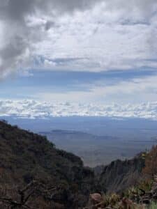
Often called the crown jewel of Big Bend hiking, the South Rim offers some of the most breathtaking views in Texas. The route climbs steeply through forest and emerges at the rim, where sheer cliffs drop thousands of feet to the desert below. On clear days, you can see more than 100 miles into Mexico.
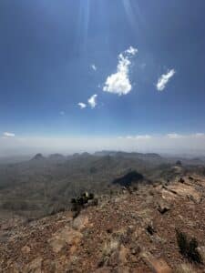
Mountains for over 100 miles
Most hikers make this a loop, climbing up through the Pinnacles and Boot Canyon and then returning through Laguna Meadow. The meadow is a welcome change of pace after the steeper sections, with serene meadows and gentler grades that let your legs relax a little. No matter which direction you choose, this is a demanding route, and many hikers stretch it into a two-day backpacking trip. It can be done in one (brutal) day if you are prepared and start early.
Tom and I were testing ourselves for a Guadalupe Peak hike that we planned later in the year, and decided South Rim would be a good way to judge our abilities as we hadn’t done a hard hike in quite a while. South Rim is longer, but Guadalupe is steeper and has less shade and is rated more difficult. We did make it, but right around the halfway point was when I decided 5 to 6 mile hikes are my sweet spot. Bottom line, we’re glad we did it but we ended up skipping Guadalupe Peak during our later excursion!
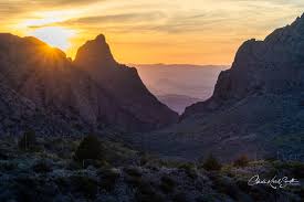
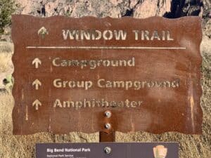
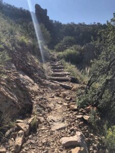
Window Trail
The view at the end of the Window Trail
Distance: 5.6 miles round trip
Elevation gain: 980 feet
Difficulty: Moderate
AllTrails rating: 4.8
Trailhead: Chisos Basin Campground
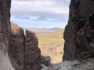
The Window Trail follows Oak Creek Canyon down to the famous Window pour-off, where water from the Basin flows out and disappears into the desert. The grade feels easy going down but remember you will be climbing back up on the return. The final stretch narrows into smooth rock polished by years of runoff. It is one of the most iconic viewpoints in the park, and the framed view of the desert below makes every step worthwhile.
The Window Trail
We have done this trail several times, and it’s one we always recommend. Our first visit is the one we still laugh about. The rocks near the end were slick from recent rain, and Tom stepped onto a wet patch and vanished from sight for a few seconds. From where I was standing, it looked like he had dropped off the edge. Thankfully he landed on a solid ledge with plenty of room to spare and popped right back up, but my heart took a lot longer to settle. The view at the pour-off is spectacular, just take your time at the end, especially when the rock is damp.
Hikes Outside Chisos Basin
Lost Mine Trail
The view across to Mexico on the way up Lost Mine
Distance: 4.8 miles round trip
Elevation gain: 1,131 feet
Difficulty: Moderate
AllTrails rating: 4.9
Trailhead: Basin Road, just before the Chisos Basin entrance
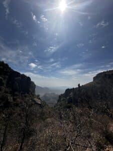
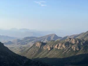
Lost Mine is one of the most popular hikes in Big Bend, and for good reason. The trail climbs steadily through the Chisos Mountains with frequent viewpoints along the way. You will see dramatic ridgelines and sweeping views of Casa Grande, Pine Canyon, and, on clear days, all the way across the Rio Grande into the Sierra del Carmen mountains in Mexico. It is one of those trails where the scenery never really lets up, and every rest break still feels like a reward.
Lost Mine Trail
The trailhead is on the road heading to the Basin, and parking is very limited. Early morning (right at sunrise) or early afternoon are the best times to arrive if you want a spot. Shade comes and goes along the way, and about half the trail has tree cover. Even in summer, mornings can be surprisingly cool in the Chisos. On July 7, 2021, we started early and it was in the 60s at the trailhead. When we returned to the car it was only in the upper 70s. That was very unusual, but still reality. It only showed how unpredictable the weather can be in this desert mountain area.
Lost Mine is our favorite hike in the park, and one we have done at least a dozen times. Our first time was on our honeymoon, and we have been hooked ever since. One of the best things about this trail is that you do not have to reach the top to enjoy it. Even if you turn around early, you will still get those big Chisos views and that incredible feeling of being high above the desert.
We once decided to hike Lost Mine as fast as we could, just to see how we would do. AllTrails lists the average time at about 2 hours 30 minutes. We finished in 2 hours 20 minutes with stops. We were very pleased with ourselves, but we still soaked in the hot tub afterward and took it easy the next day. Totally worth it!
Dog Canyon Trail
Approaching the Canyon
Distance: 4 miles round trip
Elevation gain: 331 feet
Difficulty: Easy to moderate
AllTrails rating: 4.4
Trailhead: Dog Canyon Trailhead, near the north entrance of the park
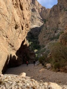
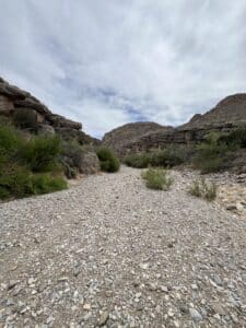
Dog Canyon Trail starts in open desert and heads toward the mouth of a dramatic limestone canyon on the north side of the park. It is mostly flat, exposed, and very windy at times, with sweeping views of the Chihuahuan Desert and the Deadhorse Mountains ahead. When you reach the canyon, the walls rise abruptly and create a cool, echoing corridor that feels worlds away from the open desert behind you.
The start of Dog Canyon Trail – stark yet beautiful
We hiked Dog Canyon on March 31, 2024, and the desert reminded us that forecasts are only suggestions out here. It was supposed to be in the 80s, but temperatures climbed to around 100 degrees on the desert floor. The beginning of the trail crosses a very arid, flat landscape, with strong wind and no shade to speak of. We passed old juniper trees that had been shaped by the harsh conditions into twisted, stunted forms, almost like natural bonsai, no more than eight to ten inches tall.
After crossing the open desert, the route drops into a dry creek bed and leads into the canyon itself. Inside, the canyon walls rise sharply on both sides, and the wind funnels through, cooling you even as the desert heat waits outside. When you reach the far end, it opens again into more rugged desert, and it is easy to imagine what early travelers must have felt moving through this wild, unforgiving terrain.
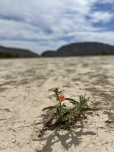
Because it was spring, we were treated to a surprising amount of desert color. Cacti were blooming, wild verbena dotted the ground, and other desert flowers added pops of color in places that otherwise look timeless and untouched. Dog Canyon is not a strenuous hike, but the environment demands respect. Bring water, sun protection, and expect the weather to have a mind of its own.
Santa Elena Canyon Trail
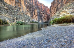
Santa Elena Canyon by Yinan Chen
Distance: 1.6 miles round trip
Elevation gain: 219 feet
Difficulty: Easy
AllTrails rating: 4.8
Trailhead: End of Ross Maxwell Scenic Drive
Santa Elana Canyon is a short trail that climbs a rocky bluff and then descends to the edge of the Rio Grande, where canyon walls rise more than a thousand feet on both sides. It is one of the most photographed places in Big Bend, and the cool canyon shade is a welcome change after time in the desert sun.
Santa Elena Canyon was another honeymoon stop for us, and it still feels special every time we go. This is one of the easiest trails in the park, with very little elevation gain, and the payoff feels much bigger than the effort. The trail runs right along the Rio Grande, with sheer canyon walls towering overhead and the water moving quietly beneath you.
Trail access can be restricted after rain because the river crossing can flood and turn muddy fast, so check conditions before you go. When the trail is open, the walk is calm and steady, and the river breeze and shade give you a break from the heat.
There is something visceral about standing next to a river that has sustained people for thousands of years. The canyon walls feel ancient, the river feels alive, and it is easy to understand why artists and photographers return again and again. Whether you sit beside the river or wander deeper into the canyon, this spot stays with you long after you leave.
Pine Canyon Trail
Starting the hike towards Pine Canyon
Distance: 4 miles round trip
Elevation gain: 980 feet
Difficulty: Moderate
AllTrails rating: 4.7
Trailhead: Off Glenn Springs Road, about 6 miles from the main road
Pine Canyon feels like you have stepped into a secret pocket of the Chisos. The trail begins in open desert grassland with mountains rising all around you, then gradually climbs toward the base of the peaks. Before long you find yourself walking along a rocky creek bed, and the landscape shifts from desert to a cool, shaded canyon filled with trees.
You’ll find a variety of trees in Pine Canyon
The variety of trees here is one of the surprises. You will see Arizona pine (the namesake), oak, maple, juniper, and impressive stands of madrone with smooth red bark and twisting limbs. Fallen leaves line parts of the trail, and the air feels cooler and still as you move deeper into the canyon.
The trail ends at a tall rock amphitheater and a seasonal waterfall. It was dry when we visited, but during the rainy season the water can flow dramatically down the cliff. Even without water, the setting is beautiful and peaceful, with stone walls rising high above and a soft echo in the air.
The road to the trailhead is unpaved and can be rough, especially after rain, and high-clearance cars are recommended. Check conditions before heading out as the road can be washed out.
This hike is not crowded compared to the Basin trails, and it delivers a surprising mix of desert and mountain scenery in a relatively short distance. It feels like discovering a hidden side of Big Bend.
Drives
Ross Maxwell Scenic Drive
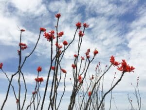
Ocotillo on Ross Maxwell Scenic Drive
Ross Maxwell Scenic Drive is a 30-mile road from the park’s central area to Santa Elena Canyon is one of the most rewarding drives in Texas. It winds through ancient lava flows, dry washes, and desert hills, with plenty of overlooks and short trails along the way. Stop at Sotol Vista for a panoramic view of the canyon in the distance, visit the Tuff Canyon and Mule Ears overlooks, and end your drive at Santa Elena for one of the park’s most famous views. Allow about two hours for the drive with short stops, or half a day if you plan to explore along the way. Roadtrip Locals has a great map of the area.
Chisos Basin Road
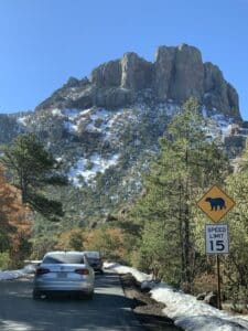
The road to the Chisos Basin after it snowed
This steep, winding road climbs from the desert floor to the cooler heights of the Chisos Basin. The drive itself is only about six miles each way, but it gains more than 2,000 feet in elevation. It’s narrow, scenic, and filled with photo opportunities as you approach the Basin surrounded by rugged peaks. Take your time and pull off safely at the overlooks to enjoy the changing perspective of the mountains as you climb. The National Parks Service has a detailed map that includes the Basin roads and trails.
Use Alpine as Your Basecamp

By Sharon Copp Haney, one of many great Alpine Murals
Big Bend rewards early starts and slow evenings, which is why staying in Alpine makes so much sense. After long hikes, dusty boots, and hours under open sky, coming back to a real bed, a quiet town, good food, and hot coffee in the morning is its own kind of luxury. Alpine sits in the middle of it all, close enough to reach the park comfortably, yet far enough away to enjoy a calm night, a good meal, and a soft landing between desert adventures.
When you spend your days exploring canyons, mountains, and river country, it’s nice to return to a place where the biggest decision left is whether to unwind by a fire pit, soak in a hot tub, or plan tomorrow’s trail over a glass of wine.
Stay With Us at Alpine Bed and Breakfast

Breakfast is ready!
If you’re planning a trip to Big Bend, we’d love to host you at Alpine Bed and Breakfast. Our home-cooked gourmet breakfasts, peaceful setting, and restful rooms give you space to recharge, refuel, and get ready for the next day’s adventure. Guests often tell us they feel spoiled here and that’s exactly the point. You spend your days in rugged country. Let someone take care of you before and after.
We also offer to-go breakfasts if you’re headed out early to get a parking spot at Lost Mine or want to see the sunrise at Panther Junction.
Book your stay at Alpine Bed and Breakfast and make Alpine your base for exploring Big Bend and the wide-open beauty of Far West Texas. We look forward to welcoming you and making your time here memorable, restful, and delicious.
Come stay with us!
Contact Us
For more information or to inquire about availability, please contact us at:
Phone: (432) 538-7032
Email: innkeeper@alpinetxbnb.com
Website: www.alpinetxbnb.com
We look forward to welcoming you to Alpine Bed and Breakfast, where unforgettable memories are made.
Sharon & Tom
Alpine Bed and Breakfast
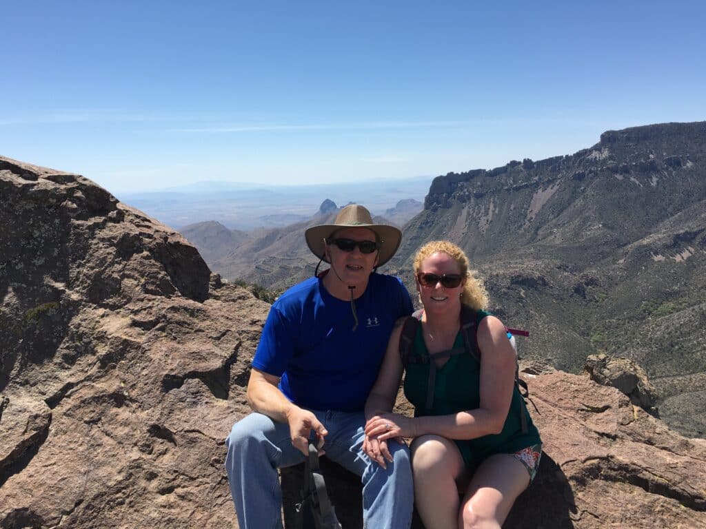
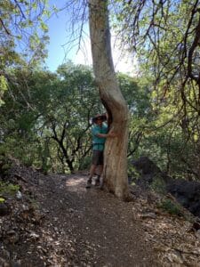
Tom & Sharon at the top of Lost Mine Trail